

Dynamic 3D visualization and multiple levels of detail (LoD)
In the burgeoning field of digital Earth technology, we take an interest in methods of multiple levels of detail (LoD) derivation and designs of data structures aiding their effective management. In particular, we focus on the adaptive generalization of terrain models and features that influence its shape. We are also interested in data fusion of models with different LoDs ranging from planet-wide representations down to 3D models of tiny objects.
1. Visualization and generalization of 3D models of the Earth's surface
- BRŮHA, Lukáš & Jan KOLÁŘ. A procedural footprint enhancement of global topographic surface with multiple levels of detail, International Journal of Digital Earth, 2020, roč. 13, č. 4., s. 527 – 545. Dostupné také z: https://doi.org/10.1080/17538947.2018.1543362
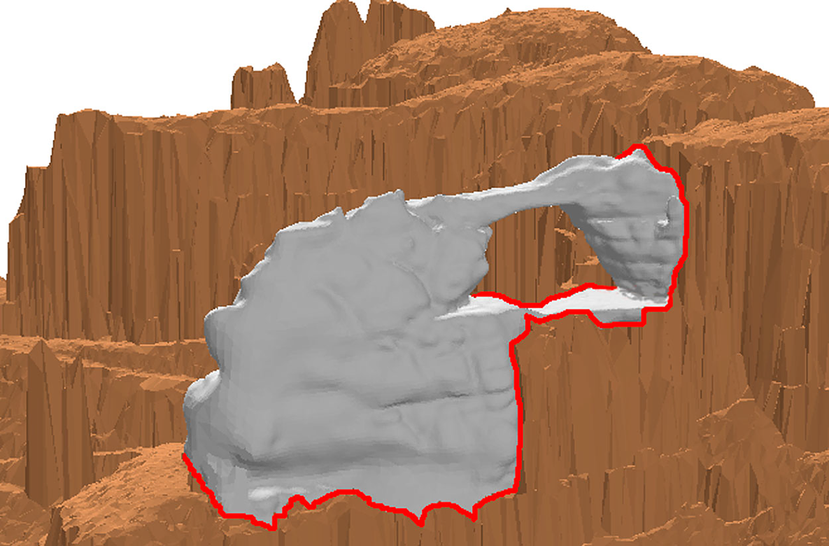
Virtual globes are technologies for visual navigation through a threedimensional, multi-resolution model of the entire planet. Data representations used in virtual globes, however, lack geometric flexibility at high-resolution levels of the planet-wide terrain surface. This is a problem especially if boundaries between individual geospatial features and the terrain are important. A novel integration of individual polygonal boundaries with a specific multi-resolution representation of the planet-wide terrain is developed in this article. In the preparation stage, the integration relies on an original simplification algorithm applied to the polygonal boundaries between geospatial features and the terrain. Its output is a multiple level-of-detail (LOD) geometry, which can be combined with a known multi-LOD representation of the terrain that uses run-time triangulation. This data representation is suitable for storage in existing database systems, avoids any data redundancy across LODs, and is even independent of the subdivision schema that partitions the planet’s surface for the sake of dealing with LODs. At runtime, a novel reconstruction algorithm stitches geometric parts from different LODs together in a manner that augments the multi-LOD representation of the terrain. Within a certain proximity range from a given position, the method reconstructs a scene that preserves topological relations between the boundaries of geospatial features with the terrain. The method also guarantees that certain nearest proximity to the given position consists of the best geometries that correspond to the original datasets. Such properties of the method close up the gap between a mere exploratory visualization of static, pre-generated models and the models supporting geospatial analysis, which is deemed crucial for applications in Geographic Information Systems, Building Information Modelling and other software industries. A prototype implementation and experiment results that prove this method are also presented.
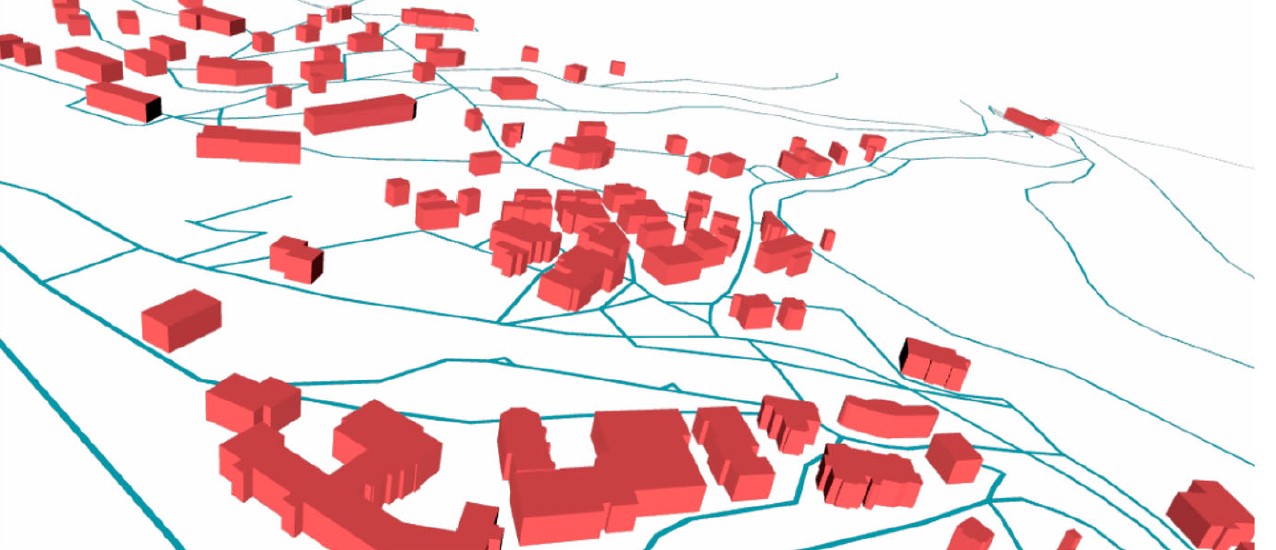
Fig. 1: Multi-LOD - the LoD is decreasing with increasing distance from the observer position
|
|
 |
 |
||
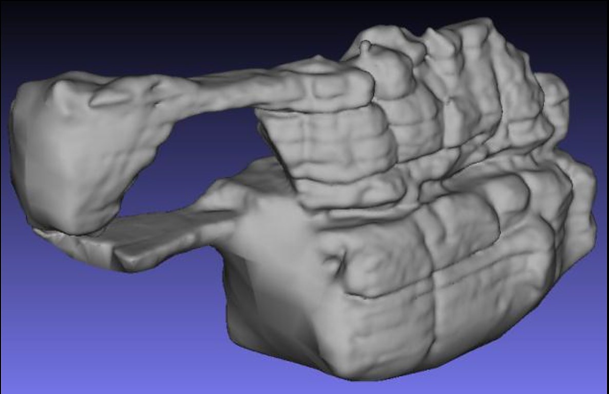
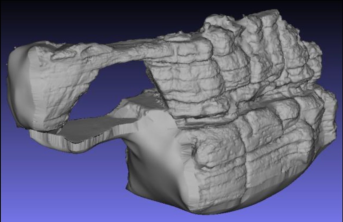
| Fig. 2: Pravčická brána | Fig. 3: Pravčická brána - coarser LoD |
Fig. 4: Pravčická brána - finer LoD |
2. Level of detail in the reconstructions of the built heritage
- BRŮHA, Lukáš, Josef LAŠTOVIČKA, Tomáš PALATÝ, Eva ŠTEFANOVÁ & Přemysl ŠTYCH. Reconstruction of Lost Cultural Heritage Sites and Landscapes: Context of Ancient Objects in Time and Space, ISPRS International Journal of Geo-Information, 2020, roč. 9, č. 10. Dostupné také z: https://doi.org/10.3390/ijgi9100604
Diachronic studies play a key role in the research and documentation of cultural heritage and its changes, ranging from architectural fragments to landscape. Regarding the reconstructions of lost cultural heritage sites, the determination of landscape conditions in the reconstructed era goes frequently unheeded. Often, only ruins and detached archeological artefacts are remaining of the built heritage. Placing them correctly within the reconstructed building complex is of similar importance as placing the lost monument in the context of the landscape at that time. The proposed method harmonizes highly heterogeneous sources to provide such a context. The solution includes the fusion of referential terrain models of different levels of detail (LOD) as well as the fusion of diverse 3D data sources for the reconstruction of the built heritage. Although the combined modeling of large landscapes and small 3D objects of a high detail results in very large datasets, we present a feasible solution, whose data structure is suitable for Geographic Information Systems (GIS) analyses of landscape and also provides smooth and clear 3D visualization and inspection of detailed features. The results are demonstrated on the case study of the Island monastery, vanished medieval town Sekanka, and the surrounding landscape, which is located in Czechia and was subject of intensive changes over time.
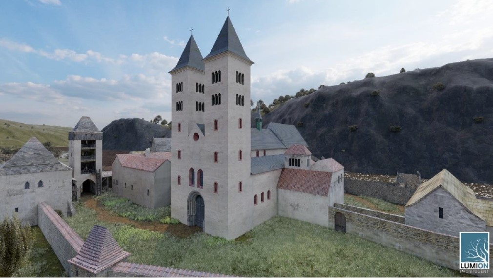
Fig. 5: The reconstruction of the former Abbey of the Decollation of St John the Baptist
 |
 |
 |
||
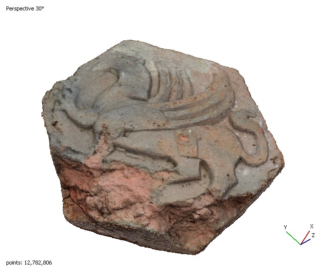
| Fig. 6: Dense cloud of a detailed feature - finest LoD |
Fig. 7: Dense cloud of a detailed feature - simplified |
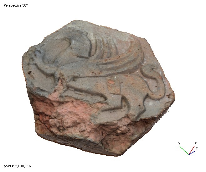
Fig. 8: Dense cloud of a detailed feature - coarsest LoD |