

Web Cartography
Web cartography combines cartography and geoinformatics with web technologies, visualization and sharing of spatial data on the Internet using open software or data. Our Cartographic Research team focuses primarily on producing of web map applications and mobile applications using Google Maps API, Mapy.cz REST API and Leaflet and OpenLayers JavaScript libraries.
Two of our outputs are presented on this website:
Our other web map applications:
- Landscape transformation in the Malešice-Hostivař industrial area and its surroundings in 1841-2022
- Digital atlas of defunct landscapes of the Czech Republic
- Extinct landscapes of the Czech Republic
- Disappeared Landscapes of the Czech Republic (mobile app)
- Database of the digitized map collections
- Water on the maps of our country from 16.-17. century
Animations
- Animation of the Battle of Chotusice 11742
- 3D Model of the Interior of the Faculty of Science, Charles University
- Kampus Albertov
- Defunct village Mušov
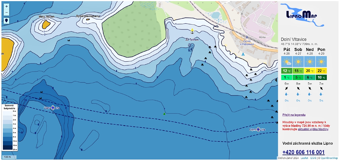
1. Web map application of Lipno Dam for water sports
Oldřich Záhoř
The web map application was created as part of Oldřich Záhoř's bachelor thesis. The aim was to create a web map application for a part of the Lipno dam using its own bathymetric mapping. It is a free web application showing the situation on and below the surface of Lipno I. The application will help to increase the safety of the movement of boats on the reservoir and will facilitate the planning of navigation and the selection of suitable anchorages for all its users.
Data collection
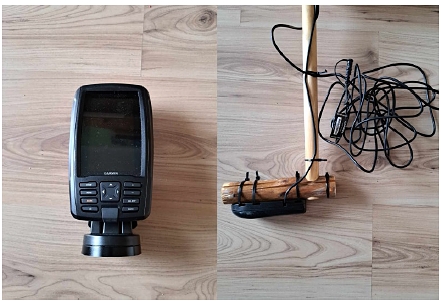
The creation of the application was preceded by the collection of own data using a Garmin ECHOMAPTM 42cv sonar and a Garmin eTrex 30 GPS tracker. The mapping method was chosen based on a comparison of four modern bathymetric data collection methods in the theoretical concept of this thesis. In the course of data collection, detailed bathymetric data were acquired for most of the Lipno I dam. Important objects located on the water surface as well as potentially dangerous objects lying at shallow depth below the water surface were also targeted.
 |
 |
 |
 |
|||
|
Fig. 1: Laminate boat with an outboard motor for data collection in shallow depths |
Fig. 2: Sailboat for water reservoir mapping |
Fig. 3: Garmin ECHOMAPTM 42cv sonar with Garmin GT20™ probe |
Fig. 4: Waypoints plotted in Maps.cz (left) and the resulting measured points from the sailboat and small boat (right) |
Web map application creation
The development of the application was realized in the open source QGIS software environment and using the freely available Leaflet library. The result of the work is an interactive web map application consisting of web pages and a web map showing the bathymetry of Lipno I along with many other elements.
 |
 |
|
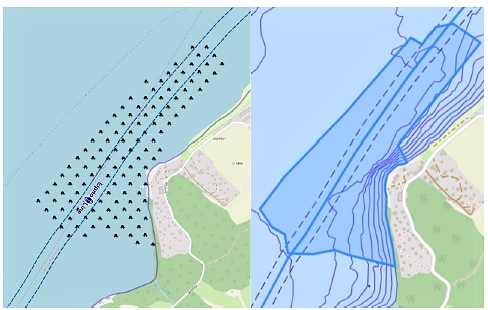
| Fig. 5: View of the stump polygon on the bottom and the Lipno-line route in the QGIS project (left) and in the web map (right) before adjustment of the layers | Fig. 6: Preview of the web map application |
The web map application is available at: https://lipnomap.unas.cz.
Bachelor thesis: https://dspace.cuni.cz/handle/20.500.11956/181380.
![]()
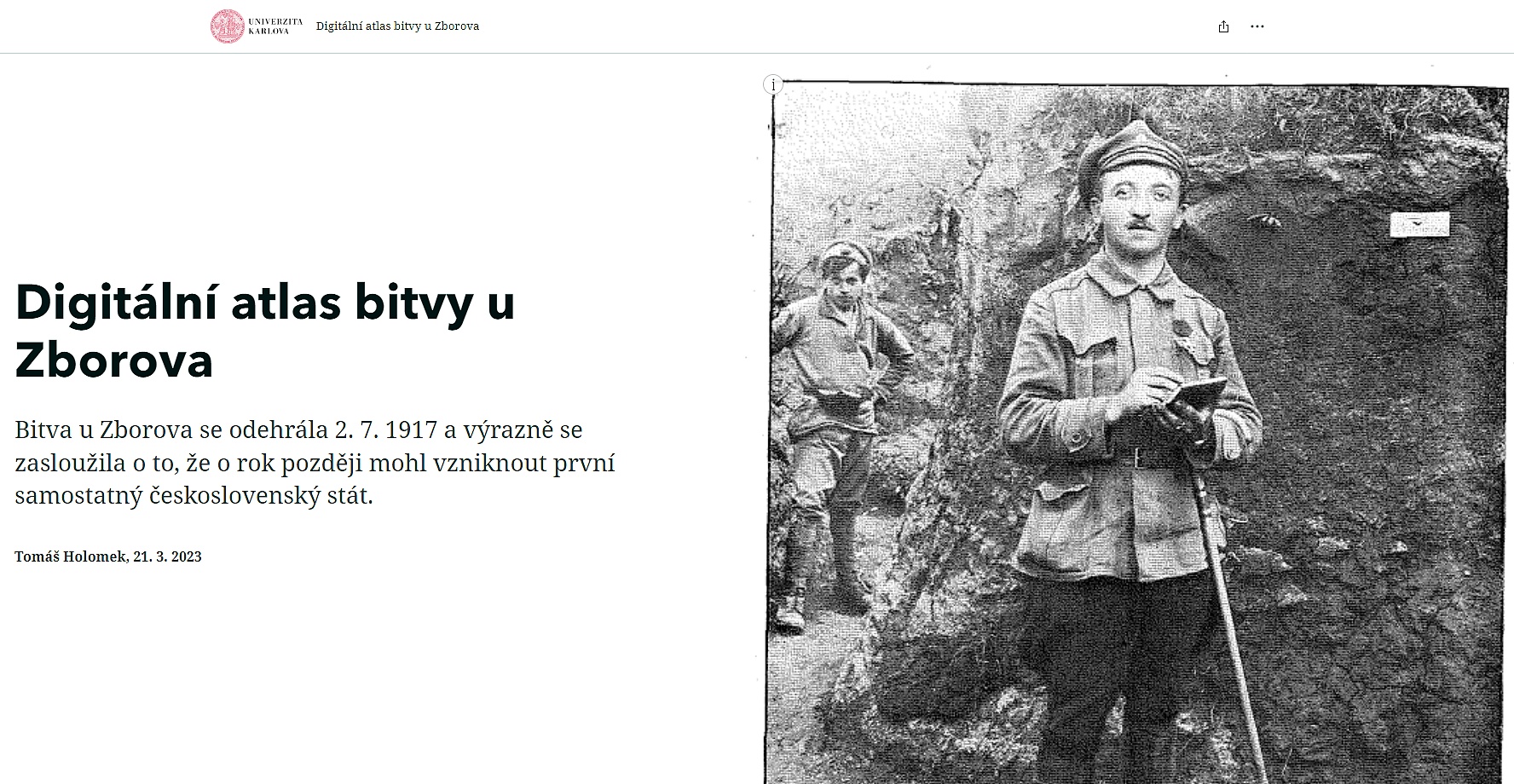
2. Digital atlas of the Battle of Zborov
Tomáš Holomek
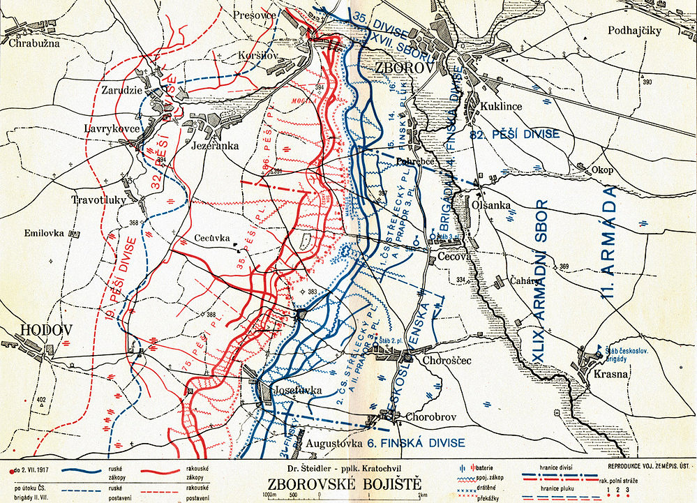
The digital atlas of the Battle of Zborov was created in 2023 by Tomáš Holomek as part of his bachelor thesis at the Department of Applied Geoinformatics and Cartography at the Faculty of Science of Charles University. The atlas was created as an imaginary electronic supplement to Vladimír Klecanda's 1927 book "The Battle of Zborov: a military-historical study of the Czechoslovak Brigade's fighting in Halych in 1917". Its main contribution is the presentation of the war conflict in an attractive form using multimedia and interactive elements. Another advantage of the work is undoubtedly the vectorization of plans from the book by Václav Klecanda, which in analogue form are mostly without supporting data and are harder to read. The plans are thus clearer in digital form over the underlying map.
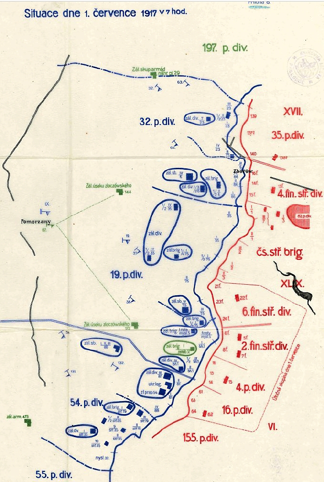
Figures 1-4 are examples of the input data.
 |
 |
 |
 |
|||
| Fig. 1: Military History Map - Zborov Battlefield | Fig. 2: Organisation of Böhm-Ermolli's military group (Klecanda 1927). | Fig. 3: The situation of Böhm-Ermolli's military group on 31 May 1917 (according to the records of its headquarters) (Klecanda 1927). | Fig. 4: The situation of the IX Corps and the 54th Infantry Division and the situation on the Russian side on 1 July 1917 at 7 a.m. (Klecanda 1927). |
The digital atlas of the Battle of Zborov was created as a so-called story map using ESRI tools, especially ArcGIS Storymap. It is divided into nine parts with cartographic appendices, for which the author used the OpenStreetMap base map. The thematic map layers are in vector format and are based on the digitized and georeferenced cartographic annexes of the publication.
The atlas provides clear and comprehensible information about the causes, course and consequences of the Battle of Zborov and could be described as a digital supplement to the publication by Vladimír Klecanda. The author's ambition is to use one of the most modern cartographic forms to reach the widest possible public so that this war conflict and the fallen soldiers are not forgotten.
Application: https://arcg.is/0fCWHH,
Bachelor thesis: https://dspace.cuni.cz/handle/20.500.11956/181380
 |
 |
|
| Fig. 5: Preview of the application | Fig. 6: Home page of the application |
Through the Map and Data Centre of the Geographical Section of the Faculty of Science, Cartographic Research Team also participates in the management of scientific spatial data, their cataloguing, accessibility and visualization. Any related issues and questions are directed to our external members Josef Laštovička and Jan Svoboda.