

Digitization, Visualization and Accessibility of Globe Virtual Collection: Case Study Jüttner’s Globe
The globes are special cartographic documents; therefore, they are also described in a special way. The research dealed with the digitization, visualization and accessibility of an old globe by Josef Jüttner from 1839. A simple model for a new virtual processing of the globe collection at Charles University was presented. SfM-MVS photogrammetry was chosen for digitization of the globe. The basic elements of the copperplate were set as basic parameters for image acquisition. Contrast, density, black line, line, dash and dot patterns and their complex use were observed for a good graphic design of the globe. New metadata were extracted from the bibliographic description. The virtual 3D globe was integrated into the existing globe database using the Cesium JavaScript library. Metadata and a 3D model of the globe were linked together and made available to the general public on the Globe page of the Map Collection of the Faculty of Science of Charles University. New graphic elements were identified with the new processing. It was possible to read the factual information written on the globe. Different possibilities and limitations of metadata description, photogrammetric methods and web presentation was described. This good practice can be applied by other virtual map collections.
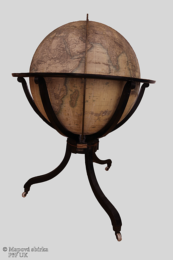
An Earth globe called Erdkugel with a diameter of 62.4 cm, with a circumference of 165 cm and a height of about 115 cm, is dated 1839. (Fig. 1). It is made on a scale of 1 : 21 000 000. Josef Jüttner published the work in Vienna. The engravers are Bernhard Bitter and Johann David, a Viennese engraver. The globe is made of plaster, covered with paper globe pieces. The stand is a wooden painted tripod on wheels. The globe is enclosed by a brass meridian circle with an engraved scale. Equipment complemented by a vertical wooden circle with calendar and signs with a calendar and zodiac signs. The globe was restored in 2016 by Miroslav Široký.
 |
 |
 |
||
|
Fig. 1: The restored Jüttner's globe from the Map Collectionof the Faculty of Science, Charles University |
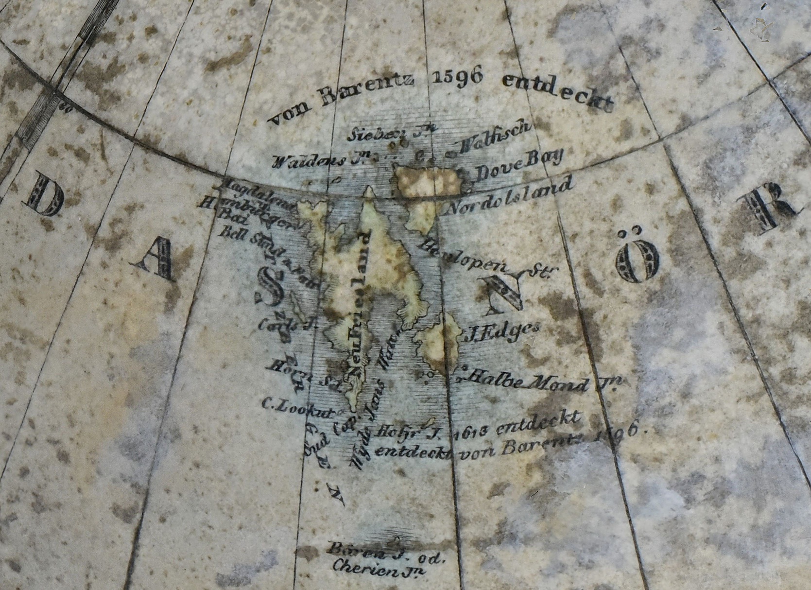
Fig. 2: German written cartouche | Fig. 3: Example of geographical notation of the discovery "von Barentz 1956 endeckt" |
Transcription of the German title and author's cartouche (Fig. 2)
ERDKUGEL von 2 Wiener Schuh im Durchmesser nach den neuesten geographischen Bestimmungen entworfen und herausgegeben von Joseph Jüttner Oberstlieutenant im Kais Königl. Bombardier Corps; in Kupfer gestochen von Bernhard Bitter und Joh. David.
Globe of the 2 Viennese steps on average according to the latest geographic determinations designed and published by Josef Jüttner, Lieutenant Colonel Artillery; engraved in copper by Bernhard Bitter and Joh. David.
Points of interest
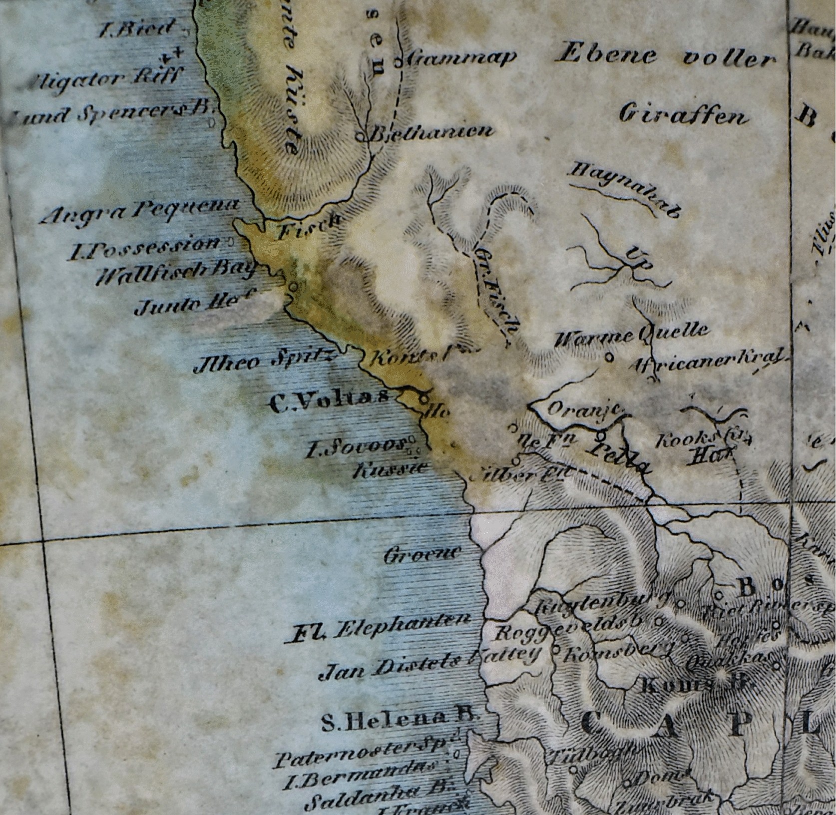
The globe is inscribed with the geographical discoveries. For example, the following can be found here entries: von Barentz 1596 entdeckt (Fig. 3), Neu Seeland von Abel Tasman entdeckt 1642, Neu Georgie. Endeckt von Roche 1675, wieder aufgesucht von Cook 1775 u. Bellingshausen 1819. Territory of the Unknown Land (Unbekannte Laender) is shown in the area of African continent (Fig. 4). Surprisingly, information on the occurrence of giraffes (Ebene voller Giraffen) in southern Africa (Fig. 4). In particular, on the coast there are the descriptions of the harbours are so dense that reminiscent of the old portulan maps (Fig. 4).
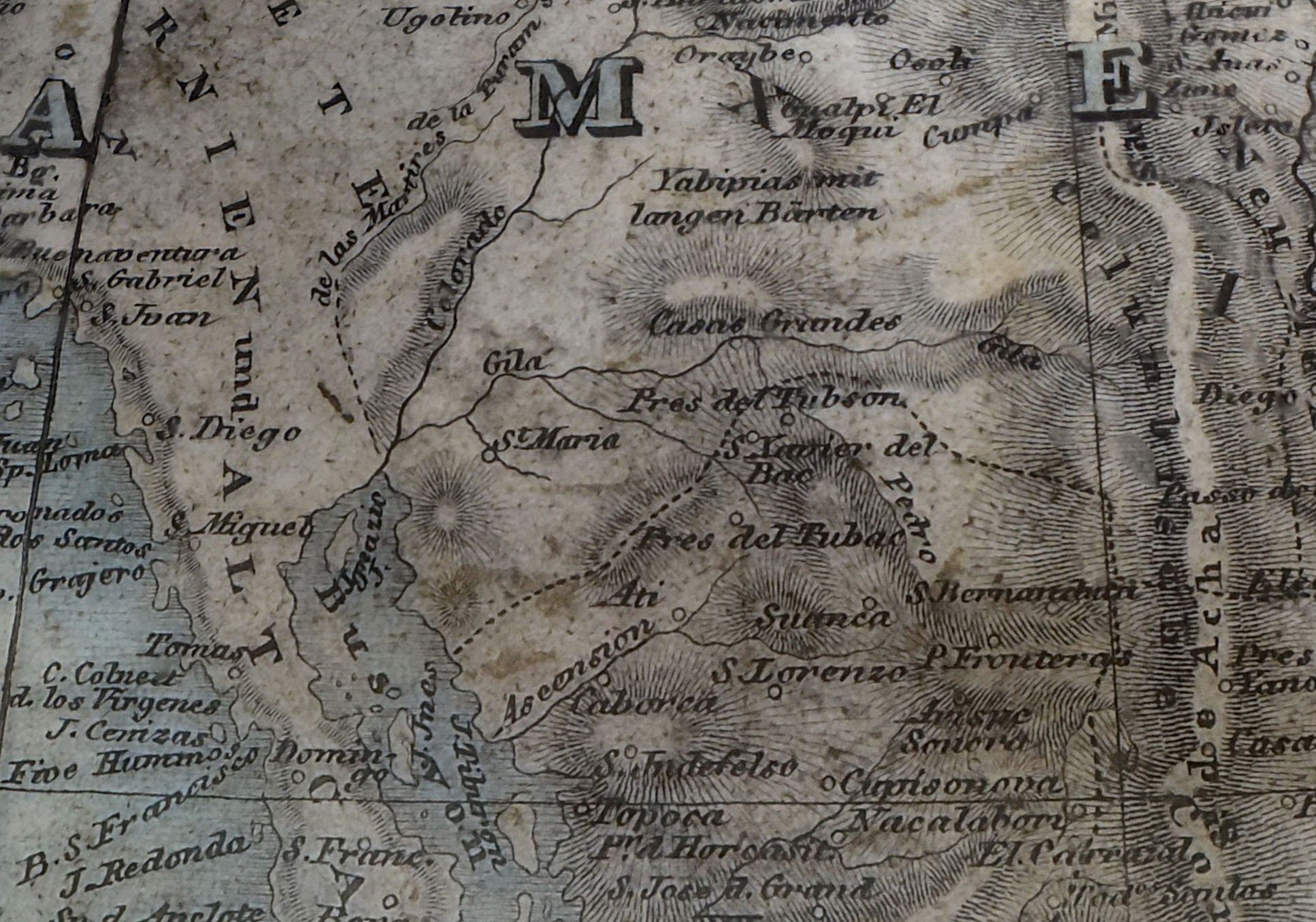
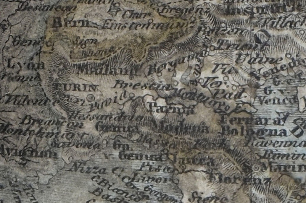
The dashed lines (Fig. 5) depict national borders and show the contemporary geopolitical division of the world. German descriptions of geographical names can be recognised on the globe. Toponyms in Europe (Fig. 6) are so oversaturated that they are almost illegible. The author clearly aimed at completeness.
 |
 |
 |
||
| Fig. 4: Territory of the Unknown Country and information on the giraffe's range. | Fig. 5: Example of border dashed lines | Fig. 6: Densely written toponyms in Europe |
The 3D model
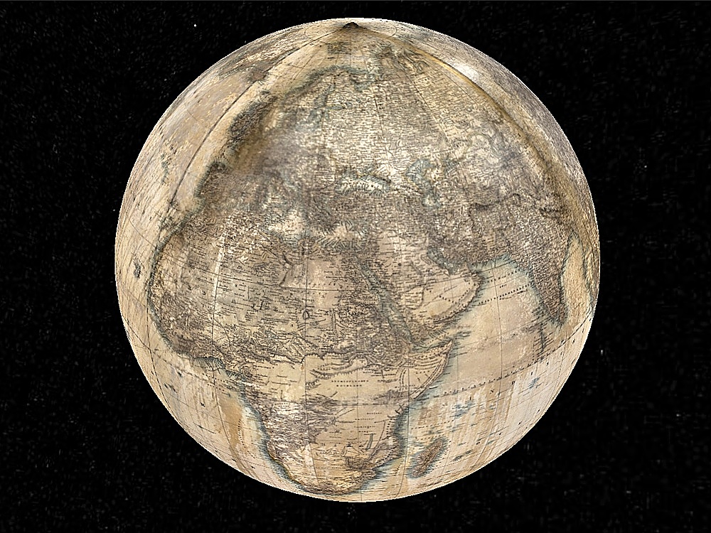
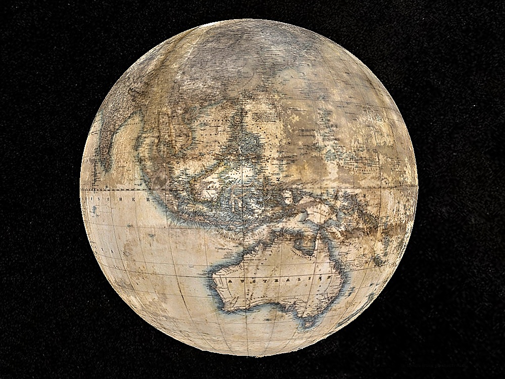
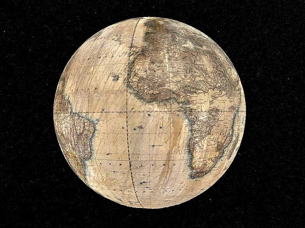
Jüttner's globe was digitized for easier interpretation and a 3D model was created (see diagram). The 3D model of the globe is available on the website of the Map Collection of the Faculty of Science of Charles University. The 3D model of the globe is part of the Digital Globe Collection of the Faculty of Science of Charles University. View the 3D model.
 |
 |
 |
||
| Fig. 7: 3D model of the globe | Fig. 8: 3D model of the globe | Fig. 9: 3D model of the globe |
Refereces
[1] ŠTEFANOVÁ, E., NOVOTNÁ, E., ČÁBELKA, M. (2023): Digitization, Visualization and Accessibility of Globe Virtual Collection: Case Study Jüttner’s Globe. ISPRS International Journal of Geo-Information, 2023, 12(3), ISSN 2220-9964. https://doi.org/10.3390/ijgi12030122, IF=2.800.